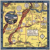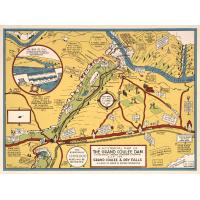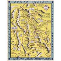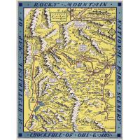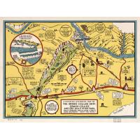
The Lindgren brothers of Spokane, Washington, “began as printers and sign makers in the prosperous 1920s. As the Depression took hold, they added humorous maps of the Pacific Northwest to their product line. Designed by Jolly Lindgren and produced using silk-screen stencils, the maps were tagged “hysterical maps”. Jolly declared at the time: “What this country needs now is something to put a smile on people’s faces” More information here:
The Library has a few of the series in it's collection,
Replies displayed by creation date
Thanks for the reminder about this map  Peter Pappas . There are some teaching ideas from a post a few years ago that might be of interest, too. Hysterical Maps https://tpsteachersnetwork.org/maps-geography/hysterical-maps
Might students use these as a model to draw their own hysterical neighborhood or school site map?
Good idea and reminds me of another mental mapping exercise https://peterpappas.com/2012/01/mental-mapping-video-game-maps-drawn-from-memory.html
Testimonials
- I love that there is new info on the site daily!
- I had a wonderful time working with the Library of Congress and learning about all of the resources at my fingertips!
- The TPS Teachers Network has an equal exchange of ideas. You know it's not a place where you're being judged.
- My colleagues post incredibly fine resources and ideas....the caliber of the suggestions and resources make me feel that I take a lot from it. It's a takeaway. And I hope that I can give back as much as I get.
- Going into this school year, I have a fantastic new resource for my own instruction and to share with my colleagues!
- I am very glad that I discovered the TPS Teachers Network through RQI. Great resources can be hard to find out there on the internet!

