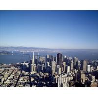
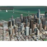
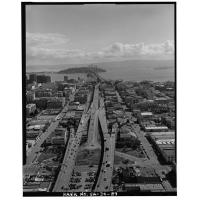
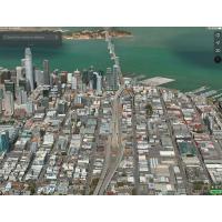
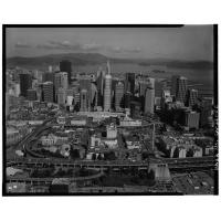
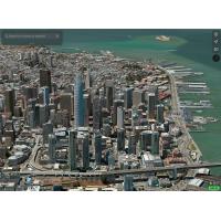
This interesting blog post from Picture This Library of Congress Prints and Photos:Double Take: Dating a Photo had a link at the bottom in Learn More of aerial views of washington d.c. I changed the end of that search URL to San Francisco and got some sky high and fairly current historic views of San Francisco.
Comparing these several decades old photos with the new 3D updates in apps such as Apple Maps can be wonderful sparks for students to dig into comparisons and questions about:
- Engineering
- City growth and planning
- Environment factors
- The future effects of climate change
I’ve added a couple of these to this album. If you find some you like from a city near you, please add.
Maps Engineering City growth Climate Change San Francisco Aerial 3D maps
Testimonials
- I love that there is new info on the site daily!
- I had a wonderful time working with the Library of Congress and learning about all of the resources at my fingertips!
- The TPS Teachers Network has an equal exchange of ideas. You know it's not a place where you're being judged.
- My colleagues post incredibly fine resources and ideas....the caliber of the suggestions and resources make me feel that I take a lot from it. It's a takeaway. And I hope that I can give back as much as I get.
- Going into this school year, I have a fantastic new resource for my own instruction and to share with my colleagues!
- I am very glad that I discovered the TPS Teachers Network through RQI. Great resources can be hard to find out there on the internet!

