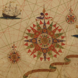
In this interview with the PBS NewsHour, Betsy Mason, co-author of All Over the Map: A Cartographic Odyssey (National Geographic, 2018), "discusses how maps of all kinds help people understand the ways in which people, places and ideas are connected, and how we can relate to the world around us."
I suspect that anyone who teaches with maps as primary sources would not disagree!
Replies displayed by creation date
I especially was intrigued by:
"There is some science suggesting that our brains interact with spatial diagrams like maps in a different way than anything else. People tend to believe them. You put something on a map and it looks true. It feels true. There’s an idea that maps are trying to display some reality."
And looking for bias, point of view:
"And if you know how to look at a map, you can learn all sorts of things about the map maker’s intents and priorities — and their ideas about the world and about themselves."
I love this article and I love maps. I use either a google map or atlas or road map every day. I like both a gps and paper map for traveling since, as the article points out, the paper map teaches us so much about the place and puts the location and so much more in context. A first search project for my students (graduate students who are teachers) is to find a map of their home area. They typically are surprised by how much they learn and by the variety. As an example I share this map of Houston Co. MN (1871) that shows the land where my great grandfather established a farm. Several of the places depicted by the photos are also in LOC. Students often search for maps such as this or in plat books.
One of the first activities my students (graduate students who are teachers) do is to find a primary map about their home area. They tend to be quite surprised by the wide variety of mas and how much they can learn from a single map. An example I use is an 1871 map of Houston County, MN.
The map shows the farm my great grandfather established. Many students enjoy finding a map of this type.

Testimonials
- I love that there is new info on the site daily!
- I had a wonderful time working with the Library of Congress and learning about all of the resources at my fingertips!
- The TPS Teachers Network has an equal exchange of ideas. You know it's not a place where you're being judged.
- My colleagues post incredibly fine resources and ideas....the caliber of the suggestions and resources make me feel that I take a lot from it. It's a takeaway. And I hope that I can give back as much as I get.
- Going into this school year, I have a fantastic new resource for my own instruction and to share with my colleagues!
- I am very glad that I discovered the TPS Teachers Network through RQI. Great resources can be hard to find out there on the internet!

